
Knofla Conservation Area
- Conservation Area closed from Sunset to Sunrise.
- Motorized Vehicles are Prohibited.
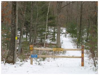
- Trail Map
- Management Plan - Adopted August 25, 2015
- 2015 Dam Inspection Report
- GPS Coordinates: 41.90484,-72.38196
- Boundary GPS Data for south parcel
- Boundary GPS Data for north parcel
The north parcel of the Knofla Conservation Area is a 70.5 acre parcel of land on the north side of Bakos Road (#148) and east side of Hunter Road in the north central section of Tolland. It was purchased from the Knofla Family Trust by the Town of Tolland on December 22, 2009 with assistance from an Open Space and Watershed Land Acquisition Program grant from the State Department of Energy and Environmental Protection.
The south parcel of the Knofla Conservation Area is a 67.6 acre parcel of land on the south side of Bakos Road (#119). It was purchased from Keystone Enterprises by the Town of Tolland on May 21, 2014 with assistance from an Open Space and Watershed Land Acquisition Program grant from the State Department of Energy and Environmental Protection.
North Parcel
This parcel is within an “Important Wildlife Areas and Corridors with Significant Natural Habitats” and is in a chain of several conservation parcels: Campbell Peaceful Valley Conservation Area and Stoppleworth Conservation Area to the west and the Schindler/Schmidt Conservation Area and Palmer Kendall Mountain Conservation Area to the east. All are Town-owned passive open space areas and are protected in perpetuity. A hike can be easily made of the five areas with only the smallest of road use needed.
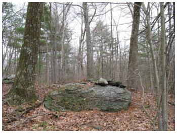
It is located in the Charters Brook watershed which is part of the Shenipsit Lake Watershed public water supply system. The parcel contains a mixed forest cover and wetlands including a 1.5 acre bog area in the southerly section of the parcel. The bog area contains a variety of amphibians and reptiles. An array of wildlife can be found on the parcel. In addition to the diverse species of hardwoods, the parcel has an abundance of Mountain Laurel and wildflowers providing habitat for wildlife, including deer, fox, coyote, and a number of smaller animals such as raccoon, squirrel, and chipmunks. Birds are plentiful including forest songbirds, hawks, owls, pheasants, partridge, and waterfowl.
South Parcel
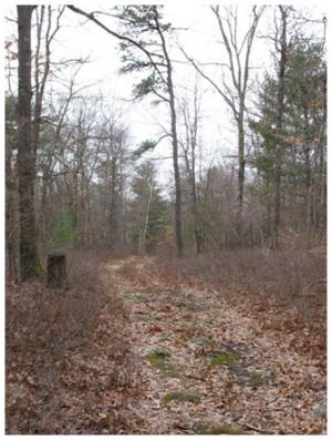
This parcel has two noncontiguous sections of frontage of 500 feet and 1,059 feet on Bakos Road. At its northwestern corner at Bakos Road, the parcel has an elevation of approximately 800 feet above sea level; it slopes gently to the center of the parcel to an elevation of approximately 750 feet above sea level and then more sharply to the edge of the pond to an elevation of approximately 700 feet above sea level. The eastern third of the parcel is primarily wetlands which includes a 5.74 acre pond. A 2,300 foot long woods road leads to the pond from Bakos Road.
The pond is approximately 9 feet in depth at its deepest part. From the dam, the pond bottom is flat for the first 10 feet and then drops off into the excavated area. It is fed by ground water, springs and Cemetery Brook which flows into the northern end of the pond. A small seasonal brook also flows into the pond at the southern end. The dam has a copper shear gate to regulate the water level. An earthen dam creates the pond and an underground spillway allows Cemetery Brook to continue its journey to Shenipsit Lake. The dam is an earthen embankment dam with a primary drop inlet spillway and an auxiliary overflow spillway.
Summarizing from the most recent Dam Inspection Report, which can be found below: Hazard Classification: BB, Dam Height: approximately 9 feet, Dam Length: 115 feet, Spillway Length: 45 feet, Spillway Type: drop inlet, Normal Freeboard: 3.5 feet, Drainage Area: 0.58 square miles, Impoundment Area: 5.65 acres.
Most of the parcel is woodland and was managed by the owners under a Forest Management Plan for family recreational use; maintenance of its natural woodland beauty; improvement through annual cordwood cuttings; and improvement of the wildlife habitat and food supply. As hardwoods have been harvested, the White Pine and Hemlock stock has increased. A small portion of the parcel is classified as Productive Forest Soils.
This is a deer and turkey habitat and other small forest animals are seen. The pond’s appearance and cool temperature – due to the springs – is indicative of a healthy aquatic habitat. The brooks and springs yield a continuous water flow. Beavers and woodchucks live around the pond area. The pond used to be stocked by the former owners with brown trout and brook trout; it now has an abundance of bullheads. This parcel is in the Shenipsit Lake Watershed public water supply system and the water from the pond flows toward the reservoir.
More pictures are on our Knofla Facebook page.